

BloomFinder: Algal Advisory Service
Stay Ahead with Near Real-Time Bloom Alerts

BloomFinder™ is a dedicated project that assists recreational users of Lake Winnipeg's South Basin.
By providing near real-time information on algal blooms, BloomFinder™ enhances public understanding of the lake's dynamic nature and supports informed decision-making for safe and enjoyable lake activities.
-
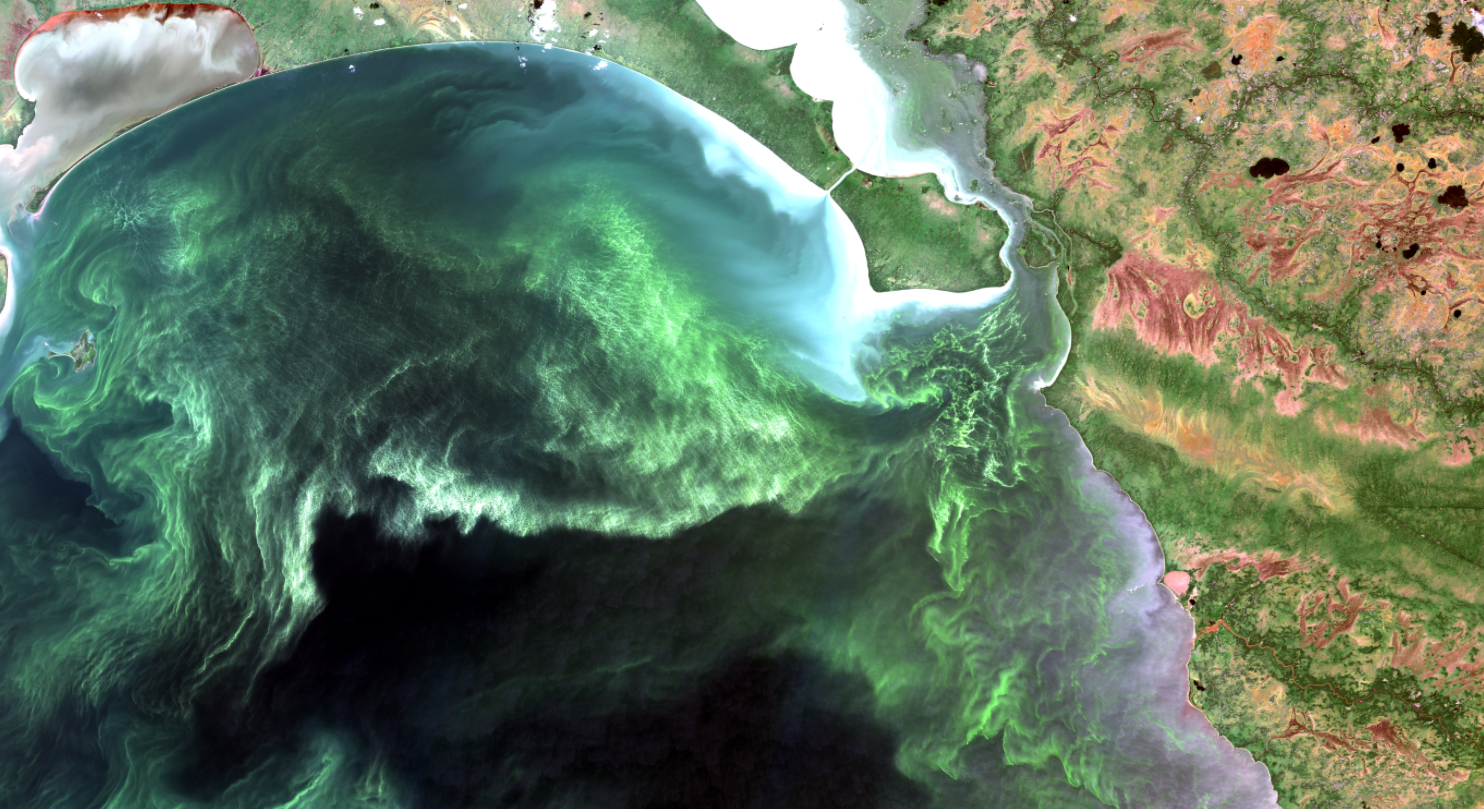
High-Resolution Satellite Imagery: Tracks algal blooms and water quality changes with precision, allowing for early detection and intervention.
Social Media Updates: Engages the community with timely information and observations, keeping everyone informed about current conditions.
Real-Time Beach User Reports: Combines satellite data with user-generated updates for comprehensive and accurate monitoring.
-
Facebook Group: Connect with other users, share updates, and learn about the latest in algal bloom science and lake dynamics, fostering a sense of community and collaboration.
Educational Outreach: Enhances public awareness and knowledge about algal blooms and their impact through workshops, webinars, and informational materials.
-
South Basin Focus: Addresses the unique environmental challenges of the area, specifically the Lake Winnipeg’s South Basin, to develop targeted solutions.
Public Resource: Empowers local communities with the information needed to safely enjoy the lake and make informed decisions about water activities.
-
Provides up-to-date information on algal blooms, helping users plan safe recreational activities and avoid potential health risks.
Promotes understanding of environmental changes and their effects on lake health, encouraging proactive measures to protect the ecosystem.
-
Fosters a connected and informed community that actively participates in monitoring and protecting Lake Winnipeg, creating a collective effort towards maintaining the lake's health and safety.
Get Updated
Join the BloomFinder community on Facebook to stay updated and contribute to our collective knowledge about lake dynamics.